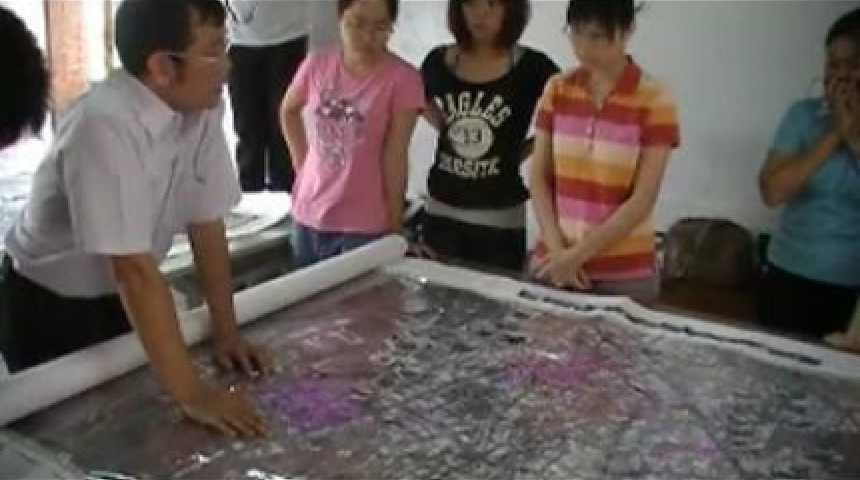
防災地圖系列二~防災地圖座談會 2010/10/31 16:28 ・ 3,863次瀏覽 ・ 0次分享 ・ 0則留言 PeoPo推 2 檢舉 地區 臺灣 屏東縣 佳冬鄉 分類 社會關懷 社會關懷 標籤 藍色東港溪 防災地圖 東北亞 南臺灣 版權創用CC 姓名標示-相同方式分享 3.0 台灣 (CC BY-SA 3.0) 授權條款 分享 Your browser does not support the video tag. Video Player is loading.Play VideoPlaySkip BackwardSkip ForwardMuteCurrent Time 0:00/Duration -:-Loaded: 0%Stream Type LIVESeek to live, currently behind liveLIVERemaining Time -0:00 1xPlayback RateChaptersChaptersDescriptionsdescriptions off, selectedSubtitlessubtitles settings, opens subtitles settings dialogsubtitles off, selectedAudio TrackPicture-in-PictureFullscreenThis is a modal window.Beginning of dialog window. Escape will cancel and close the window.TextColorWhiteBlackRedGreenBlueYellowMagentaCyanOpacityOpaqueSemi-TransparentText BackgroundColorBlackWhiteRedGreenBlueYellowMagentaCyanOpacityOpaqueSemi-TransparentTransparentCaption Area BackgroundColorBlackWhiteRedGreenBlueYellowMagentaCyanOpacityTransparentSemi-TransparentOpaqueFont Size50%75%100%125%150%175%200%300%400%Text Edge StyleNoneRaisedDepressedUniformDrop shadowFont FamilyProportional Sans-SerifMonospace Sans-SerifProportional SerifMonospace SerifCasualScriptSmall CapsResetDoneClose Modal DialogEnd of dialog window. 藍色東港溪協會 防災地圖系列二~防災地圖座談會 分享到 Facebook 內嵌: 620x420 620x460 (4:3) 360x240 360x270 (4:3) 手繪防災地圖已完成,現階段陸續與各村庄村長們做地圖的討論,希望能將防災地圖更完善、更貼切村庄需求。 除了與村長們討論防災地圖的完整性,更希望藉此協助村庄完備防災小組,以因應災難發生時的應變能力,讓傷害降到最低。


回應文章建議規則: